Page content
- Basic facts
- Lectures
- Practical Classes
- Documents for practical classes
- Homeworks
Basic facts about subject
- Code: 154FS01
- Lectures: Ing. T. Křemen, Ph.D.
- Practical classes: Ing. T. Křemen, Ph.D. (head of the classes),
- Hours per week: 2+3
- Credits: 6
- End: unclassified assessment, exam
- Room: practical classes / lectures: B969 / B971
Annotation
Introduction to surveying, basic geodetic calculations, evaluation of precision and accuracy of a measurement, theory of errors, instrumentation, topographic survey, angular and distance measurements, determination of heights, photogrammetry, laser scanning, mapping, setting-out in construction, surveying for monitoring of displacements, cadastre of real estates.
Acknowledgement
This website was created and updated in the framework of the project: Online learning support for flexible teaching of new courses of the Geodesy and Cartography programme taught in English (105 1052201A003 FCE)
Tyto stránky byly zřízeny a aktualizovány v rámci projektu: Online studijní opory pro flexibilní výuku nových předmětů programu Geodézie a kartografie vyučovaných v angličtině (105 1052201A003 FCE )
Recommended literature
- [1] Uren, J. – Price, B.: Surveying for Engineering (Fifth Edition). Macmillan Publishers LTd., Basingstoke, Hampshire RG21 6XS, Great Britain, 806 pages
- [2] Schofield, W. – Breach, M.: Engineering Surveying (Sixth Edition). Spon Press, 2 Park Square, Milton Park, Abingdon, Oxon OX14 4RN, 2011, 622 pages.
Lectures
Organization of lectures
- Participation in lectures is optional, but recommended.
- Program of lectures is posted in the classroom and on the website of the subject.
Contents of lectures
- Introduction: Geodesy, surveying. Shape and size of the Earth, reference surfaces. Cartographic projections (Cassini-Soldner’s, Křovák’s and Gauss-Krüger’s projections). Substitution for a sphere by a plane.
- Basic Geodetic Calculation: Rectangular and polar coordinates (bearing and distance). Intersection from angles. Traverses – closed traverse without orientation.
- Evaluation of Precision and Accuracy of a Measurement: Accuracy, precision. Errors – mistakes, systematic and random errors. Processing of measurements with the same accuracy. Law of standard deviation propagation.
- Angular Measurement: Horizontal and zenith angles. Optical-mechanical and electronic theodolites. Requirements for the axes of a theodolite. Errors in construction of theodolites, errors caused by the observer. Measurement of a horizontal angle in one set, measurement of a zenith angle in both positions of the telescope.
- Distance Measurement: Measurement with a tape. Optical methods – measurement of a parallactic angle, stadia range finder. Electro-optical methods – phase distance meters, distance meters measuring transit time. Physical correction and mathematical reduction of a measured distance.
- Determination of Heights – part 1: Absolute and relative height of a point, equipotential surface, true and apparent horizon of a point. Vertical datum in the Czech Republic. Direct levelling from the centre between the rods, technical levelling, levelling instruments, longitudinal and cross profiles levelling.
- Determination of Heights – part 2: Surface levelling. Underground connection by a tape. Barometric and hydrostatic levelling. Trigonometric method. Vertical refraction.
- Setting-Out of Buildings and Land Survey for Construction Industry – part 1: Setting-out plan, setting-out nets, setting-out of a general angle, setting-out of the right angle, setting-out of a point position, setting-out of a straight line.
- Setting-Out of Buildings and Land Survey for Construction Industry – part 2: Setting-out of a circular arc, setting-out of heights. Geodetical legal regulations in the Czech Republic.
- Measurements for Thematic Mapping and for as-built Documentation of Constructions: Spatial polar method, photogrammetry, laser scanning, remote sensing, GPS.
- State Map Series in the Czech Republic and Thematic Maps for Construction Industry: Map, plan, cartographical generalization, map contents, state map series – large-scale maps, medium-scale maps, thematic maps for construction industry.
- Cadastre of Real Estates of the Czech Republic: History of the cadastre of real estates, essential terms, records of property rights and other rights relating to real estates to the cadastre, survey sketch, ordering of geodetic service in the Czech Republic.
Practical Classes
Organization of the practical classes, credit requirements
- Participation in the practical classes is compulsory at the time specified in the schedule.
- Program of lectures is posted in the classroom and on the website of the subject.
- Students must attend the practical clases in time. Late arrivals are not permitted. 100% active participation is required.
- Homework shall be made up according to the program. Homework includes technical reports, submission deadline is the next practical lesson. Submission delay will cause reduction of the final mark.
- Marks from all tests must be E or better (if the mark in the test is F, there will be one possibility of correction).
Contents of Practical Classes
- Levelling – part 1: principles, instruments, reading of levelling rods, registration of measured data, calculation of a levelling field book.
1st Homework – Calculation of the levelling field book
- Levelling – part 2: practical measuring in the field, calculation and adjustment of a levelling line.
- Total stations – part 1: total stations Topcon GPT 2006 and Trimble M3 – description, centering, levelling, reading, pointing, horizontal and zenith angles booking and calculating.
1st Test – Calculation of a levelling field book
2nd Homework – Calculation of horizontal directions and zenith angles
- Total stations – part 2: total station Topcon GPT 2006 and Trimble M3 – angular and distance measurement without registration.
2nd Test – Calculation of horizontal and vertical angles
- Total stations – part 3: total station Trimble M3 – software, registration of a measurement, communication with a computer, tacheometry, data collecting, setting-out.
3rd homework – Spatial polar method, setting-out elements
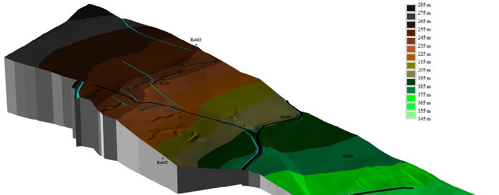
- GNSS – part 1: interpolation of contour lines, Global navigation satellite system – introduction, basic principles, GPS Trimble GeoXR – description, software, demonstration of measurement and calculations.
3rd Test – Spatial polar method, setting-out elements
4th Homework – Interpolation of contour lines
- GNSS – part 2: practical measuring in the field, comparison of results with other surveying methods.
- Situation: measurement of the planimetry for special-purpose plan creation.
- Tacheometry: tacheometric measurement for contour line plan creation.
- Interior: measurement and drawing of an interior.
- Setting-out: setting-out of an object using a total station.
- Working with map: basic cartographic measurements and calculations, altitude measurement, measurement of volume and area. ASSESSMENT
Time schedule
- Time schedule of practical classes with dates (pdf).
Documents for practical classes (recommended to print)
0. Measurement report
1.-2. Levelling
3.-5. Total stations
6.-7. GNSS
| Download | Description |
|---|
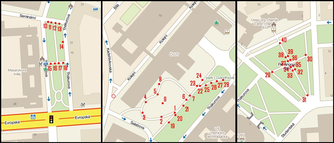
| Topography of points | map showing position of the measured points |
| Sketch | Coordinates | coordinates and topography of standpoints used for the determination of heights of measured points |
| Levelling data 34, 34a, 35 | levelling data of used permanent benchmarks |
8. Situation
| Download | Description |
|---|
| Situation sketch 1 | basis for field sketch – Masarykova dormitory locality |
| Tacheometry sketch 2 | basis for field sketch – I. Gandhí park locality |
| Sketch | Coordinates | coordinates and topography of standpoints used for the determination of heights of measured points |
9. Tacheometry
10. Interior
| Download | Description |
|---|
| Drawing | Example of drawing |
11. Setting-out
| Download | Description |
|---|
| Setting-out drawings | drawings containing setting-out elements |
| Sketch | Coordinates | coordinates and topography of standpoints used for the determination of heights of measured points |
Homeworks
1st homework – Calculation of the levelling field book
2nd homework – Calculation of horizontal directions and zenith angles
3rd homework – Spatial polar method, setting-out elements
4th homework – Interpolation of contour lines
Stránka naposledy upravena dne 21. 09. 2023 v 11:24.